
Check official city ratings first
Start your search with established, data-driven ratings rather than relying on scattered blog posts or social media trends. Two organizations dominate the field for credible, comparable metrics: PeopleForBikes and the League of American Bicyclists. Using their tools saves you hours of research and gives you a baseline for safety, infrastructure, and rider equity.
PeopleForBikes releases an annual City Ratings report that scores nearly 3,000 U.S. and international cities. Their methodology looks at five pillars: ridership, infrastructure, safety, equity, and culture. The data is transparent and updated yearly, making it easy to spot which cities are improving and which are stagnating. You can filter by population size or specific amenities to find a match for your trip style.
The League of American Bicyclists uses the Bicycle Friendly Community (BFC) program to certify cities, states, and universities. This program is older and more rigorous in its application process. Cities must submit detailed plans and evidence of policy changes to earn Bronze, Silver, Gold, or Platinum status. A high BFC rating often signals strong institutional support for biking, which translates to better maintenance and safer streets.
These two systems measure different things. PeopleForBikes focuses on the rider experience and current conditions, while the League focuses on municipal planning and long-term policy. Comparing both gives you a complete picture. A city might have great infrastructure (high PeopleForBikes score) but weak policy enforcement (lower League tier), or vice versa.
| Source | Primary Focus | Scope | Update Frequency |
|---|---|---|---|
| PeopleForBikes | Rider experience, safety, and equity | ~3,000 cities | Annual |
| League of American Bicyclists | Municipal policy and infrastructure planning | Certified communities only | Ongoing applications |
Bookmark these two databases before you book your trip. They are the most reliable starting points for identifying bike-friendly cities that align with your travel goals.
Map your daily cycling routes
General city scores give you a broad sense of a place, but they don't tell you if your specific itinerary is safe or efficient. To truly evaluate a bike-friendly city for your trip, you need to verify the infrastructure quality of the exact streets you plan to ride. This process moves you from abstract ratings to practical route planning, ensuring you avoid high-traffic hazards or disconnected paths.
Start by plotting the hotels, restaurants, and attractions you intend to visit. Instead of relying on the shortest path, identify the corridors that connect these points. This establishes the backbone of your cycling network and highlights which neighborhoods require further investigation.
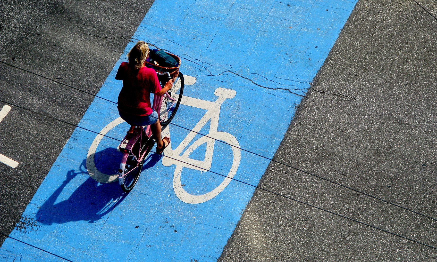
Zoom into the street view imagery to inspect the road surface between your destinations. Look for physical barriers like curbs or planters that separate cyclists from car traffic. Painted lines offer less protection, so prioritize routes with dedicated bike lanes or low-volume residential streets that function as shared spaces.
If you plan to use a bike-share system, check the density of docking stations along your route. A route is only as good as its accessibility; ensure you can pick up and drop off bikes near your key stops without long detours. This step is critical for maintaining flexibility during your trip.

Use a cycling-specific map tool to calculate travel times based on your fitness level and the route's difficulty. Urban cycling often involves more stops and slower speeds than driving, so factor in time for traffic lights and intersections. This helps you schedule your day realistically and avoid rushing through unfamiliar streets.
By following this workflow, you transform a generic destination into a navigable cycling itinerary. You will know exactly which streets to trust and which to avoid, making your trip safer and more enjoyable.
Watch local cycling videos
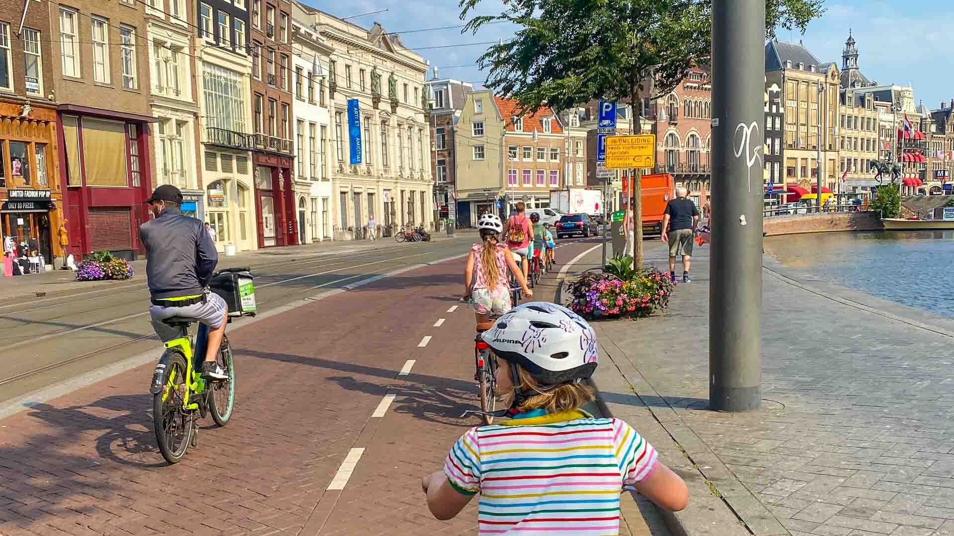
Video content offers a dynamic view of a city’s cycling infrastructure that static photos often miss. By watching real-time footage, you can assess the density of bike lanes, the behavior of local cyclists, and the overall safety of the streets. This visual evidence helps you gauge the "feel" of the city before you arrive.
Look for videos that show typical commuting hours rather than special events or empty weekend mornings. Pay attention to how cyclists interact with traffic and whether they feel protected by infrastructure. A city with wide, protected lanes will look and feel very different from one where cyclists share narrow roads with cars.
To illustrate these practical differences, consider watching a comparison of two major bike cities. This video highlights how distinct urban layouts and infrastructure choices create unique riding experiences.
Avoid common planning mistakes
A city’s reputation as a "bike-friendly" destination often masks the reality of its current infrastructure. Rankings from previous years or general media features rarely account for recent construction, lane removals, or seasonal traffic changes. Relying on outdated data can leave you navigating dangerous gaps in the network.
Always verify the current state of the bike lanes in your specific destination. Check recent local news or cycling blogs for updates on construction zones or detours. This step prevents the frustration of arriving in a city that was once a cycling paradise but is currently a construction site.
Finally, look beyond the city center. Many popular cycling destinations have robust infrastructure in downtown areas but lack safe connections to suburbs or tourist attractions. Ensure your entire itinerary, including hotel-to-restaurant routes, is covered by safe, connected paths rather than just the main tourist corridor.
Prepare your bike trip checklist
A bike-friendly city reduces risk, but it doesn’t replace preparation. Urban cycling requires specific gear and local knowledge to navigate traffic and infrastructure safely. Use this checklist to ensure you are ready for your next bike-centric urban trip.
Essential Gear
- Helmet: A properly fitted helmet is non-negotiable. Check for CPSC or EN1078 certification.
- Lights: Front white and rear red lights are required in most cities, even during the day.
- Lock: Bring a heavy-duty U-lock or folding lock. Cable locks are easily cut.
- Repair Kit: Carry a spare tube, tire levers, and a mini-pump or CO2 inflator.
- Panniers or Bag: Use a waterproof bag or panniers to keep your hands free and your items secure.
Digital Tools
- Navigation App: Download an offline map or a cycling-specific app like Komoot or Ride with GPS.
- Local Transit App: Check if your bike is allowed on trains or buses during peak hours.
- Emergency Contacts: Save local emergency numbers and the address of your accommodation in your phone.
Safety and Legal
- Insurance: Verify if your travel insurance covers cycling accidents. Consider supplemental coverage.
- Local Laws: Research local helmet laws, bike lane rules, and signaling requirements.
- First Aid: Pack a small first aid kit with bandages, antiseptic wipes, and pain relievers.
No comments yet. Be the first to share your thoughts!