
Walking is more than a high walk score
Car ownership feels like a burden in the city. Between the insurance, the hunt for parking, and the traffic, many of us are looking for a way out. We want neighborhoods where the grocery store and the pharmacy are a five-minute stroll away, not a twenty-minute crawl in a sedan.
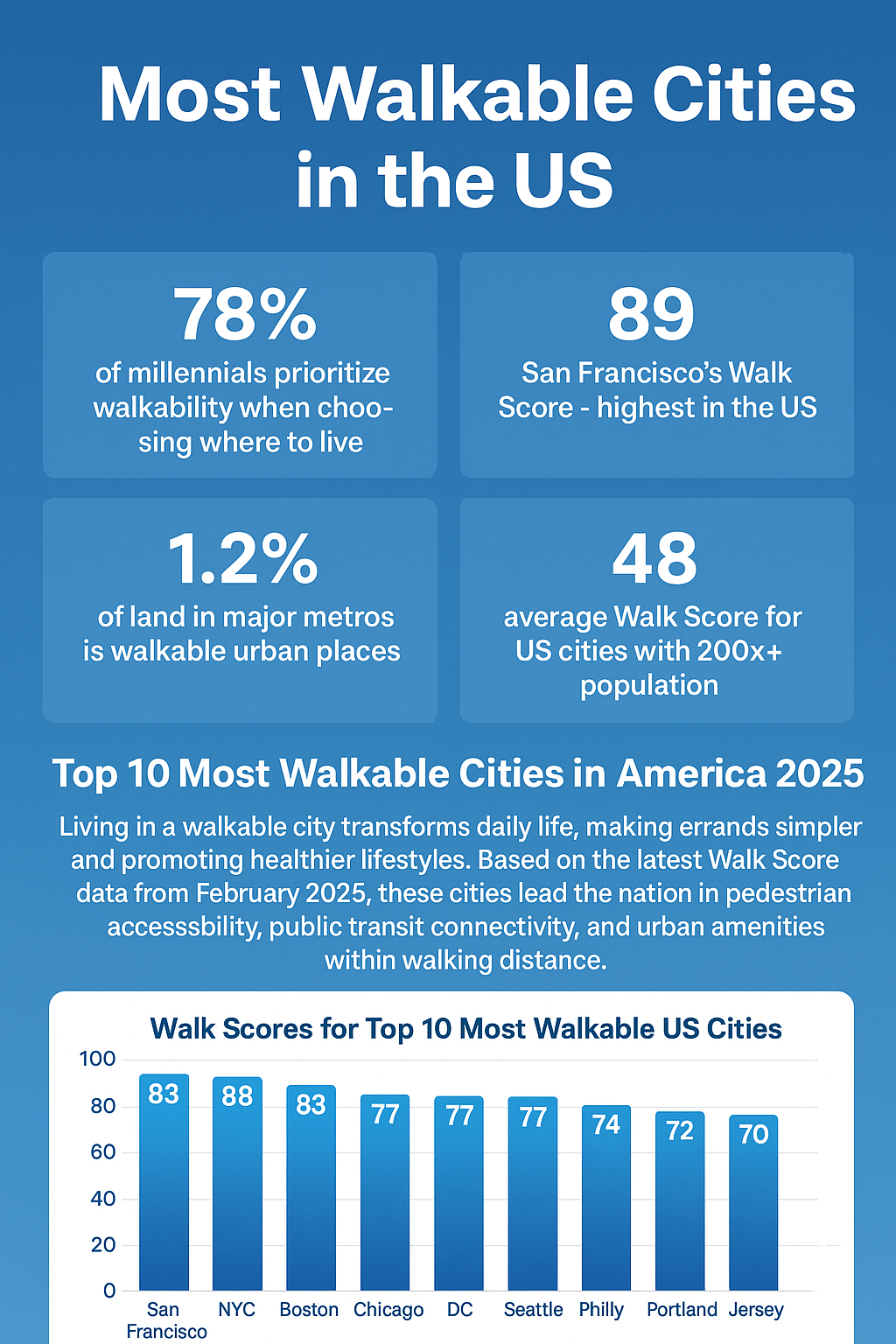
For years, “walk score” has been the go-to metric. It’s a quick and easy way to get a general sense of how easily you can run errands on foot. But it has limitations. It heavily favors proximity to a few basic amenities and doesn’t always capture the nuance of a neighborhood’s pedestrian experience – things like safe crossings, sidewalk quality, or the presence of green spaces.
The EPA's National Walkability Index offers a more comprehensive assessment. Developed beginning in 2017 and updated in 2021, it considers four key components: destination accessibility, pedestrian network, safety, and proximity to transit (see www.epa.gov/smartgrowth for the full methodology). It’s still not perfect, but it provides a far richer picture of a neighborhood’s walkability than a simple score.
We’re going to look at the top ten major US cities offering car-free lifestyles in 2026, leaning on the EPA’s index as a starting point, but also factoring in real-world experience and local insights. We'll consider not just how far you can walk, but where you can walk to, and how pleasant that walk will be. We’ll also explore specific neighborhoods within those cities that really shine for those choosing a no vehicle lifestyle.
The best cities for car-free living
Ranking cities by walkability is tricky, as different indexes weigh factors differently. This list uses a composite score based on the EPA’s National Walkability Index, adjusted for recent developments in public transit and pedestrian infrastructure as of late 2025/early 2026. Keep in mind these scores are relative and should be seen as a guide, not a definitive ranking.
1. New York, NY (88/100). Manhattan is the obvious winner here. You can live in the West Village or the Upper West Side for years without ever needing to touch a steering wheel. The subway is the backbone, but the sheer density of bodegas and shops means most of your daily needs are met within four blocks.
2. Boston, MA (Walkability Score: 85/100) Boston's compact layout and historical roots contribute to its walkability. Beacon Hill, Back Bay, and the North End are particularly pedestrian-friendly. The 'T' (MBTA) provides excellent coverage, and the city is actively investing in bike lanes and pedestrian improvements. I’ve personally found navigating Boston on foot a joy, even in winter.
3. San Francisco, CA (Walkability Score: 82/100) Despite its hills, San Francisco is surprisingly walkable. The city’s dense urban core and vibrant neighborhoods like North Beach, Chinatown, and the Mission District make it easy to get around on foot. Public transit, including Muni buses and streetcars, complements walking well.
4. Chicago, IL (Walkability Score: 80/100) Chicago’s grid system and lakefront path make it a great city for walking. Neighborhoods like River North, Streeterville, and Lincoln Park are particularly walkable. The "L" train provides extensive public transit options. The city has also been making strides in expanding its bike lane network.
5. Philadelphia, PA (Walkability Score: 78/100) Philadelphia’s historical character and manageable size contribute to its walkability. Center City, Old City, and Rittenhouse Square are all very pedestrian-friendly. The SEPTA regional rail and bus system offer good public transit access.
6. Washington, D.C. (Walkability Score: 77/100) The nation’s capital is designed for walking, with many attractions and amenities clustered around the National Mall. Neighborhoods like Dupont Circle, Adams Morgan, and Georgetown are highly walkable. The Metro provides excellent public transit coverage.
7. Seattle, WA (Walkability Score: 75/100) While Seattle's hills can be challenging, its downtown core and neighborhoods like Belltown and Capitol Hill are very walkable. The Link light rail and bus system provide good public transit options. The city is investing in pedestrian and bike infrastructure.
8. Miami, FL (Walkability Score: 72/100) Miami’s walkability varies greatly by neighborhood. South Beach is exceptionally walkable, with its Art Deco architecture and pedestrian-only streets. Brickell and Downtown Miami are also becoming more pedestrian-friendly. Public transit is improving, but still lags behind other cities on this list.
9. Minneapolis, MN (Walkability Score: 70/100) Minneapolis boasts a strong network of bike lanes and pedestrian paths, particularly along the Mississippi River. Neighborhoods like Uptown and Downtown are walkable. The light rail and bus system provide good public transit access. The city is surprisingly resilient to winter conditions.
10. Portland, OR (Walkability Score: 68/100) Portland has long been a leader in sustainable transportation. Neighborhoods like the Pearl District and Hawthorne are very walkable. The MAX light rail and bus system provide excellent public transit coverage. The city’s commitment to bike infrastructure is also noteworthy.
Most Walkable Neighborhoods in Major US Cities 2026: A Comparative Overview
| City | Walkability Score (EPA Index) | Public Transit Score (0-100) | Bike Score (0-100) | Cost of Living Index | Car-Free Vibe (1-5) |
|---|---|---|---|---|---|
| New York, NY (Manhattan) | 97 | 88 | 93 | 180 | 5 |
| Boston, MA (Back Bay) | 96 | 92 | 89 | 165 | 4.5 |
| San Francisco, CA (North Beach) | 94 | 85 | 87 | 200 | 4 |
| Chicago, IL (Loop) | 92 | 82 | 84 | 130 | 4 |
| Philadelphia, PA (Center City) | 90 | 80 | 80 | 120 | 3.5 |
| Washington, D.C. (Dupont Circle) | 88 | 85 | 78 | 150 | 4 |
| Seattle, WA (Capitol Hill) | 85 | 75 | 82 | 140 | 3.5 |
| Portland, OR (Pearl District) | 82 | 70 | 90 | 135 | 4 |
Illustrative comparison based on the article research brief. Verify current pricing, limits, and product details in the official docs before relying on it.
Neighborhoods that get it right
Let's move beyond the city-level view and look at specific neighborhoods that truly excel for car-free living. These areas demonstrate how thoughtful urban design and a commitment to pedestrian infrastructure can create thriving, walkable communities.
Greenwich Village, New York City: This iconic Manhattan neighborhood is a pedestrian paradise. The narrow, winding streets are lined with independent shops, restaurants, and cafes. Washington Square Park provides a central gathering space. Grocery options abound, from small corner stores to larger markets. The A, C, E, B, D, F, and M subway lines provide easy access to the rest of the city. It’s a place where you genuinely don’t need a car to live a full and vibrant life.
Beacon Hill, Boston: Steeped in history, Beacon Hill’s cobblestone streets and brick row houses create a charming and walkable environment. Charles Street is the main commercial thoroughfare, offering a mix of boutiques, antique shops, and restaurants. The neighborhood is close to Boston Common and the Public Garden. The MBTA Green Line provides convenient access to other parts of the city. It feels like a village within a city.
North Beach, San Francisco: Known as “Little Italy,” North Beach is a lively and walkable neighborhood with a strong sense of community. Grant Avenue is the main commercial street, lined with Italian restaurants, cafes, and bookstores. The neighborhood is close to Fisherman’s Wharf and Coit Tower. Several Muni bus lines serve the area. It’s a place where you can easily spend an afternoon wandering and exploring.
Shaw, Washington D.C.: Shaw has undergone significant revitalization in recent years, becoming a vibrant and walkable neighborhood. U Street Corridor is a hub for music venues, restaurants, and nightlife. The neighborhood is home to several grocery stores and farmers markets. The Green and Yellow Line Metro stations provide excellent public transit access. I’ve noticed a real energy in Shaw, a sense of community that’s hard to find elsewhere.
The actual cost of owning a car
Ditching a car is a massive pay raise. AAA found that owning a new car costs over $10,000 a year when you factor in the invisible drains like depreciation and maintenance. In a city like Boston or DC, that money covers a lot of Uber rides and a much nicer apartment.
Living in a walkable neighborhood can significantly reduce these expenses. You might be able to eliminate car payments altogether, or at least reduce your driving and save on gas and maintenance. Parking costs, which can be substantial in major cities, are also eliminated. According to a 2022 report by the Victoria Transport Policy Institute, households in walkable neighborhoods spend an average of $2,000 less per year on transportation.
Beyond the direct costs of car ownership, walkable areas can also impact housing costs. While demand for walkable neighborhoods can drive up property values, the overall cost of living can be lower due to reduced transportation expenses. There’s also a potential impact on healthcare costs. Studies have shown that people who live in walkable neighborhoods tend to be more physically active, which can lead to improved health outcomes and lower healthcare expenses.
Let's consider a simple example: someone living in a walkable neighborhood in Boston might spend $150/month on public transit, while a car owner could easily spend $500+/month on car payments, insurance, gas, and parking. That’s a savings of over $4,000 per year – money that could be used for other things, like travel, entertainment, or savings.
Can suburbs actually be walkable?
For decades, suburbs were synonymous with car dependency. But that’s changing. A growing movement known as 'new urbanism' is challenging the traditional suburban model and advocating for more walkable, mixed-use developments.
Examples like Reston, Virginia, and Celebration, Florida, demonstrate what’s possible. Reston, originally planned in the 1960s, features a network of walking and biking paths, mixed-use development, and a town center with shops and restaurants. Celebration, developed by Disney, is designed as a traditional town with a walkable downtown area and a variety of housing options.
Retrofitting existing suburbs to become more walkable is a more significant challenge. It requires re-zoning to allow for mixed-use development, investing in pedestrian and bike infrastructure, and improving public transit connections. It also requires a shift in mindset – a willingness to prioritize people over cars.
The success of these efforts often depends on local political will and community engagement. It's not always easy to overcome resistance from residents who are accustomed to driving everywhere. But the benefits of walkable suburbs – reduced traffic congestion, improved air quality, and increased community interaction – are well worth the effort.
Apps to help you get around
Planning a car-free commute or exploring a new walkable neighborhood is easier than ever thanks to a wealth of online resources and mobile apps. Several tools can help you find walking directions, public transit information, and bike route maps.
Google Maps is a versatile option, offering walking, biking, and public transit directions. Citymapper is another popular app, specializing in public transit information for major cities. AllTrails is great for finding walking and hiking trails. For bike-sharing programs, check out apps like Lime, Bird, and Citi Bike (availability varies by city).
Safety is paramount when walking or cycling. Always be aware of your surroundings, use crosswalks, and wear bright clothing. Consider carrying a flashlight or reflective gear, especially at night. Be mindful of traffic and pedestrians. It’s also a good idea to let someone know your route and estimated time of arrival.
Many cities also offer online resources with information on pedestrian and bike safety, as well as maps of bike lanes and walking trails. Check your city’s website for more information.
- Google Maps is the standard for basic walking and transit routes.
- Citymapper: Specialized public transit information.
- AllTrails: Walking and hiking trails.
- Lime, Bird, Citi Bike: Bike and scooter sharing.
Essential Car-Free Apps
- Google Maps - Offers comprehensive walking and public transit directions, real-time traffic updates, and street view for familiarizing yourself with routes. It integrates with many transit agencies for schedule information.
- Citymapper - Specializes in multi-modal trip planning, combining walking, biking, public transit, and ride-sharing options. It provides detailed route breakdowns and real-time arrival information in select cities.
- Transit - Focuses on real-time public transit information, including arrival times, service alerts, and crowding predictions. It supports a wide range of transit agencies across North America and beyond.
- Lime - A widely available electric scooter and bike share service. Useful for bridging gaps in walkability or quickly covering longer distances. Availability varies by city.
- Bird - Another popular electric scooter share company, offering a similar service to Lime. Check for operational cities and safety guidelines before use.
- Moovit - Provides public transit information, journey planning, and real-time updates. It includes a community-based transit editor, allowing users to contribute to the accuracy of the data.
- Local Bike Share Programs - Many cities have their own independently operated bike share systems (e.g., Capital Bikeshare in Washington D.C., Citi Bike in New York City). These often offer affordable membership options for frequent riders.


No comments yet. Be the first to share your thoughts!